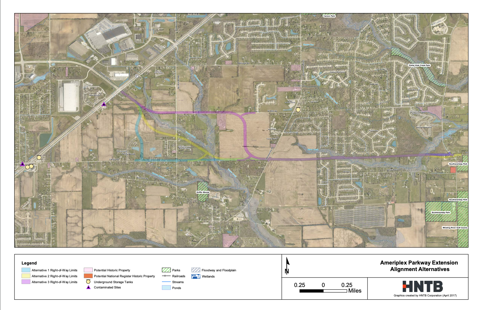
Map of Route Alternatives
The Map of Route Alternatives below shows the three proposed routes that the 2017 study identified as the alignments with the smallest possible impact to residents and the environment. The three routes shown depict the potential pathways for the extension. They do not depict the right-of-way. More information will be shared as the design phase continues and alternatives are refined.